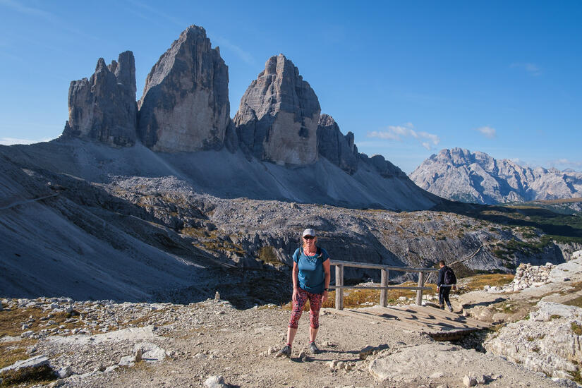
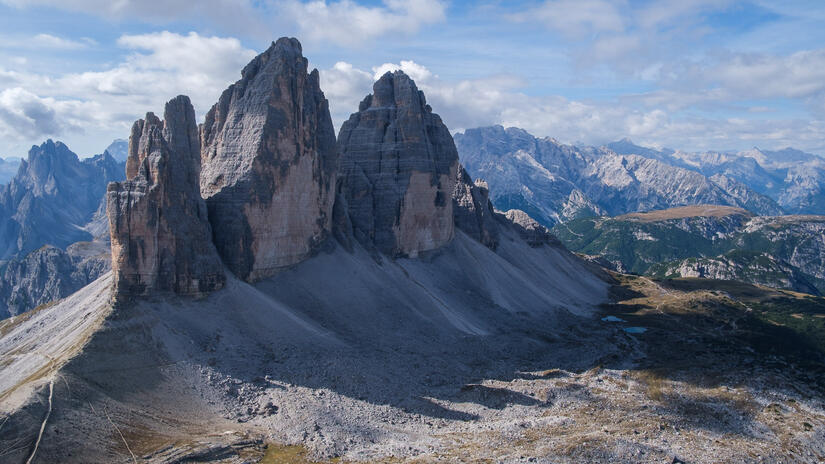
I have been wanting to visit Tre Cime/Drei Zinnen for a while now, and a perfect weather weekend at the end of September seemed like the perfect time. We headed down to the Dolomites after work on Friday and could head straight to the Tre Cime car park as overnight parking is allowed. As we arrived were were blown away by the number of campervans that were already there, but we managed to find a nice space which was very flat and not boxed in by all of the other vans.
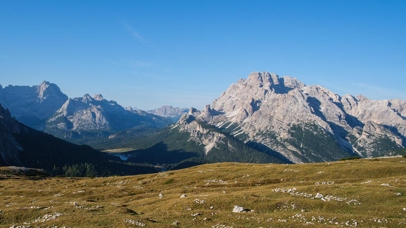
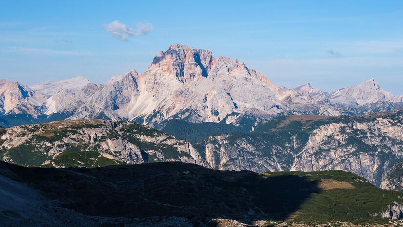
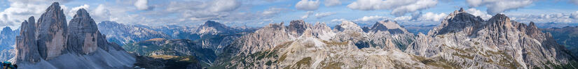
My day started by waking up in time for sunrise, which was very enjoyable, if a tad cold first thing in the morning. The car park is really high at around 2300m which means that without much ascent you can be on the top of a pretty high mountain which makes the views outstandingly good.
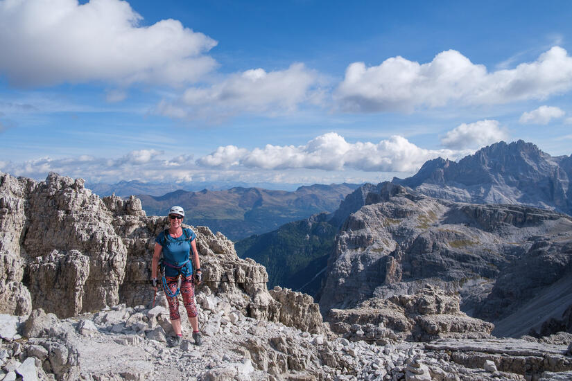
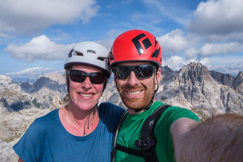
Our objective for the day was the Paternkofel, via the Innerkofler Klettersteig on the ascent, and the Schartenweg Klettersteig on the decent. This provided a longer day out than the standard route, avoided the scree gully which is described as unpleasant in the guidebook and also took us to the Büllelejochhütte for a well earned cake and beer. The route itself was not about climbing, but rather about the position and the history, as it was fairly short and without any significant difficulty.
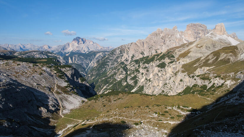
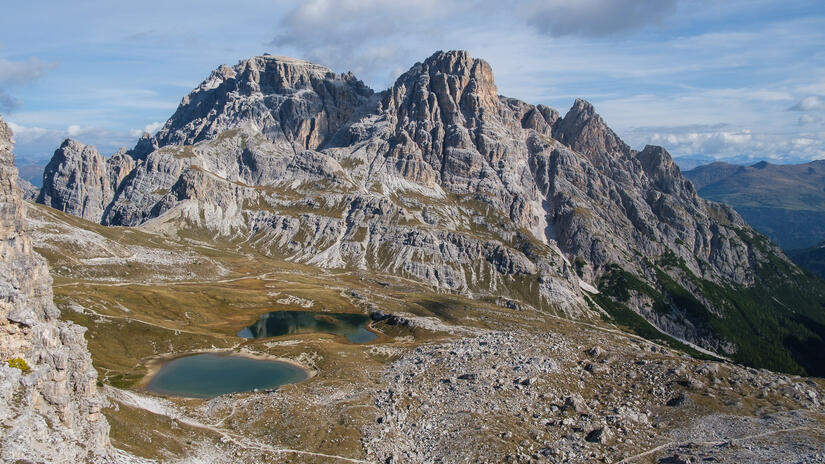
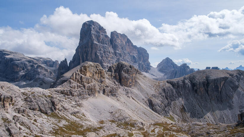
The walk was immediately brilliant as we left the car park, with outstanding views as we contoured underneath the south east side of Tre Cime and climbed up to Forcella Lavaredo. As we emerged at Forcella Lavaredo the views just became even better, as it felt like we were in the middle of big mountains, despite having only done a 30min walk from the car park.
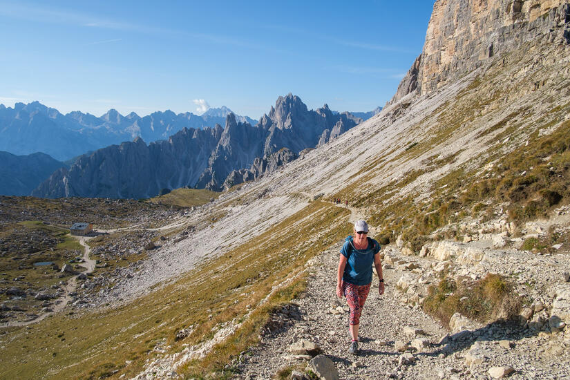
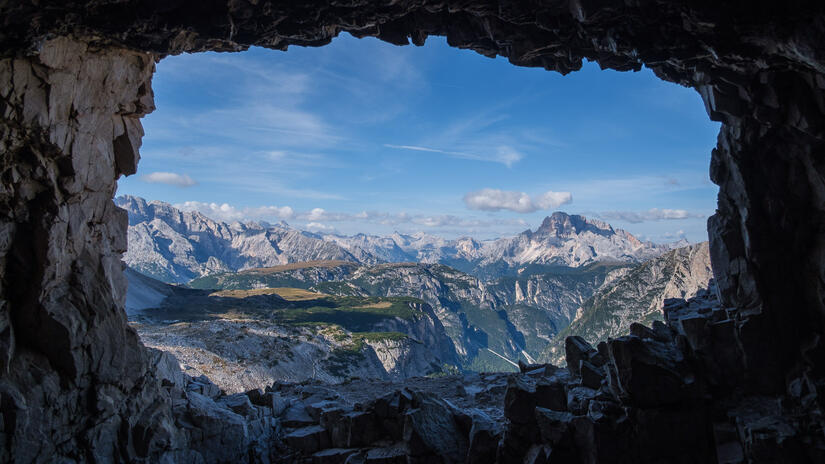
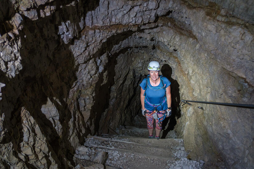
After traversing along underneath the Paternkofel, we were soon at the start of the route, which initially made its way up through tunnels which were made during WW1. These tunnels had plenty of lookouts and small bunk areas, it must have been horrific to be stationed here, but the views out from the lookouts were certainly fantastic.
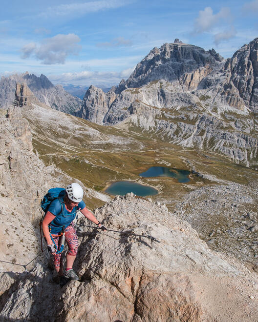
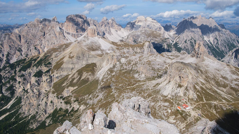
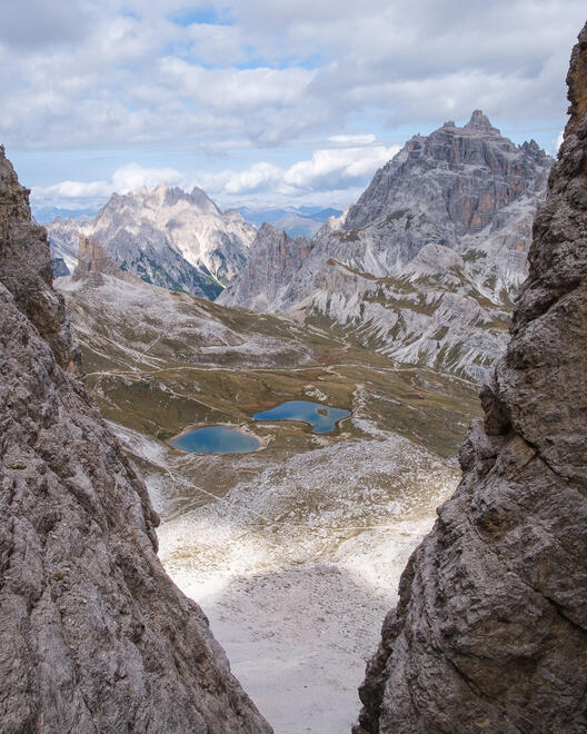
As we emerged from the tunnels there was a small amount of Klettersteig to take us up to the Gamsscharte where the Innerkofler, Schartenweg and descent to the Passportenscharte all merged. A small amount of Klettersteig then took us up to the summit, which was full of people, and for a very good reason, the view was absolutely fantastic.
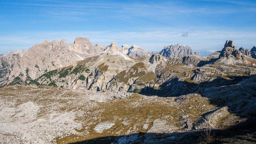
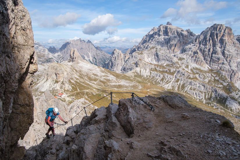
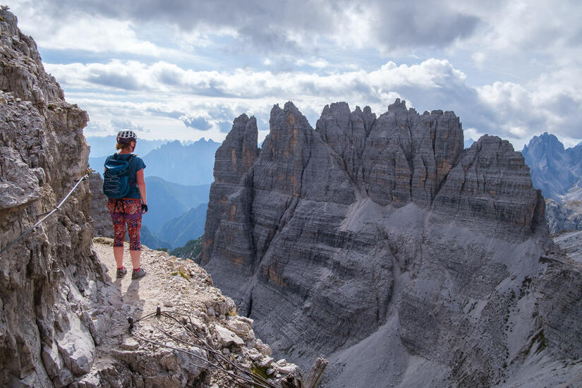
As we wanted to get off the summit before there were lots of teams descending, we enjoyed the views for a few minutes before starting our descent. We were soon back at the Gamsscharte, where we set off on the Schartenweg, which was lovely as it weaved its way along a ledge system without any difficulty, but with fantastic views.
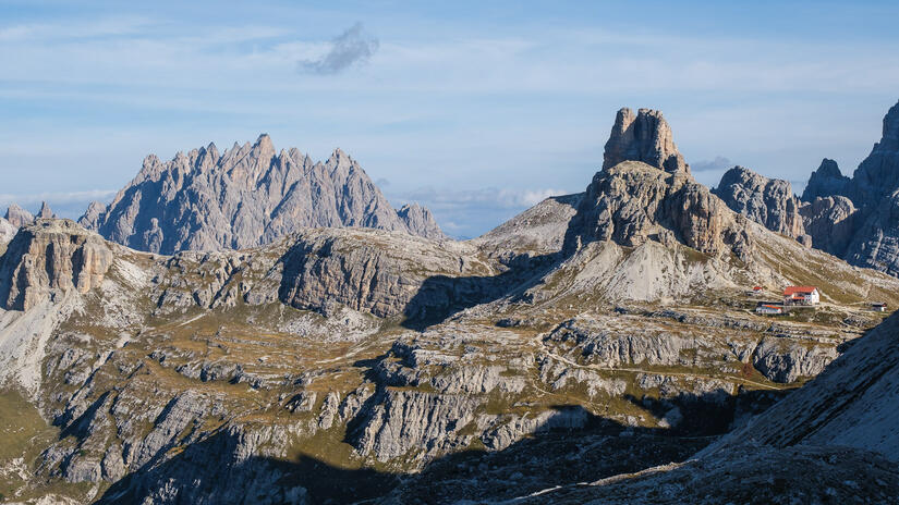
We soon arrived at what we thought was the end of the klettersteig we stopped to remove our gear and eat out lunch before starting the descent. Annoyingly we found out that this was in fact not the end of the Klettersteig, as after a bit of descending there was more klettersteig to descend down into a gully and then climb back out. After putting out gear back on for 3mins of klettersteig, we then quickly took it off again before continuing the traverse along to the Büllelejochhütte for some cake and a beer.
From the Büllelejochhütte the descent was very easy along a big path and we were soon back at the car park, where we enjoyed another beer in front of the van while admiring the outstanding view from the car park, before heading back out for sunset.
Comments